Share your favorites on Show & Tell

Early map of the Eastern Townships, Province of Quebec. 1875

In Paper > Maps > Show & Tell.
Maps86 of 169Map of Farringdon Ward by Emanuel Bowen printed 17721842-1845 Rocky Moutians by Captian Fremont
6
Love it
0
Like it

London1066London1066 loves this.
HunterHunter loves this.
blunderbuss2blunderbuss2 loves this.
fortapachefortapache loves this.
aghcollectaghcollect loves this.
See 4 more
Add to collection

    Please create an account, or Log in here

    If you don't have an account, create one here.


    Create a Show & TellReport as inappropriate


    Posted 11 years ago

    DicksonsRe…
    (3 items)

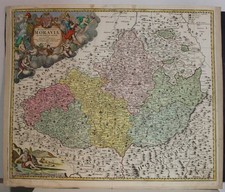
    This is an old map of the Eastern Townships (and adjacent portions of the Province of Quebec) from 1875. I found it in my old rectory at Rectory Hill in Inverness, County of Megantic. The last picture shows the boundaries of Inverness, and on the top corner of the municipality we can see Ch. which is the location of the rectory and of the former St-Stephens Church.

    logo
    Maps
    See all
    NORTH AMERICA TEXAS AS REPUBLIC 1844 WYLD UNUSUAL ANTIQUE COPPER ENGRAVED MAP
    NORTH AMERICA TEXAS AS REPUBLIC 184...
    $27
    MORAVIA CZECH REPUBLIC & POLAND 1720 HOMANN UNUSUAL ANTIQUE COPPER ENGRAVED MAP
    MORAVIA CZECH REPUBLIC & POLAND 172...
    $57
    MORAVIA CZECH REPUBLIC 1645ca JANSSON UNUSUAL ANTIQUE COPPER ENGRAVED MAP
    MORAVIA CZECH REPUBLIC 1645ca JANSS...
    $67
    MORAVIA CZECH REPUBLIC 1720 HOMANN UNUSUAL ANTIQUE ORIGINAL COPPER ENGRAVED MAP
    MORAVIA CZECH REPUBLIC 1720 HOMANN ...
    $21
    logo
    NORTH AMERICA TEXAS AS REPUBLIC 1844 WYLD UNUSUAL ANTIQUE COPPER ENGRAVED MAP
    NORTH AMERICA TEXAS AS REPUBLIC 184...
    $27
    See all

    Comments

    1. Roycroftbooksfromme1, 11 years ago
      nice, love old maps............

    Want to post a comment?

    Create an account or login in order to post a comment.