Share your favorites on Show & Tell

Kansas Map 1917

In Petroliana > Road Maps > Show & Tell.
All items167466 of 246406Loetz: Diaspora Candia c1900 Shell BowlAnchor Hocking Pink Queen Mary Flat Tumbler
9
Love it
0
Like it

ATTWOODATTWOOD loves this.
pops52pops52 loves this.
gargoylecollectorgargoylecollector loves this.
walksoftlywalksoftly loves this.
DrFluffyDrFluffy loves this.
geo26egeo26e loves this.
kerry10456kerry10456 loves this.
aghcollectaghcollect loves this.
DeanteaksDeanteaks loves this.
See 7 more
Add to collection

    Please create an account, or Log in here

    If you don't have an account, create one here.


    Create a Show & TellReport as inappropriate


    Posted 12 years ago

    Deanteaks
    (291 items)

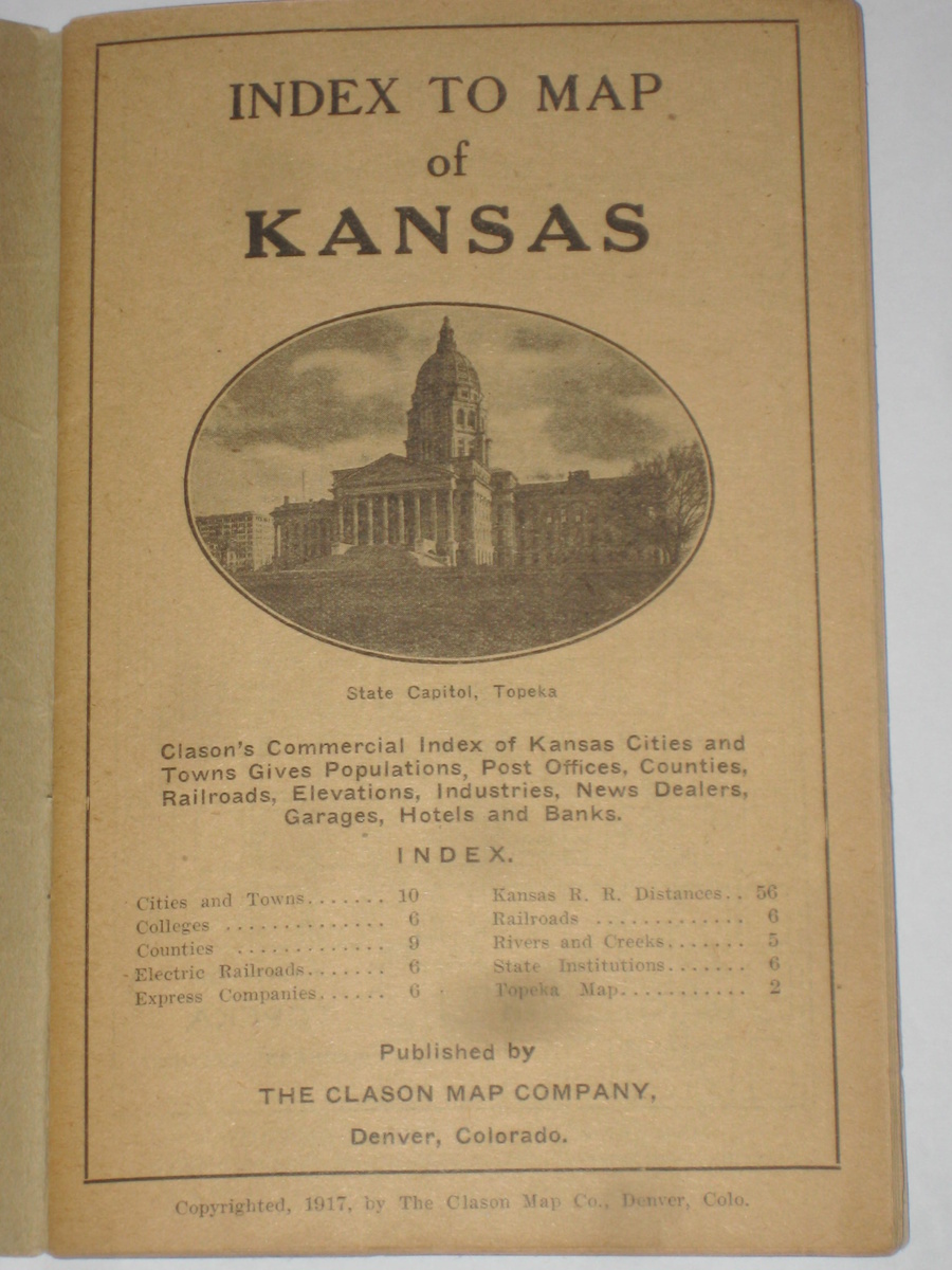
    This was a personal map that belonged to Jules A. Bourquin of Horton,Kansas in 1917, very cool I think! it is even signed by him at the top, it was before our interstate highways, it shows all railroads back them, most of them gone now, there is a full colored map in the back 17 1/2 x 17 inches in like new condition :)

    Unsolved Mystery

    Help us close this case. Add your knowledge below.

    logo
    Road Maps
    See all
    1910's Yosemite National Park Automobile Routes Map Auto Club of S. California
    1910's Yosemite National Park Autom...
    $12
    6 VINTAGE 1920's AUTOMOBILE CLUB OF CALIFORNIA ROAD MAPS
    6 VINTAGE 1920's AUTOMOBILE CLUB OF...
    $5
    1910's Automobile Club of Southern California Strip Maps 7 Different w/ Yosemite
    1910's Automobile Club of Southern ...
    $9
    Vintage Travel Road Maps 1950s Chevron Conoco Western States Lot Of 6
    Vintage Travel Road Maps 1950s Chev...
    $25
    logo
    1910's Yosemite National Park Automobile Routes Map Auto Club of S. California
    1910's Yosemite National Park Autom...
    $12
    See all

    Want to post a comment?

    Create an account or login in order to post a comment.