Share your favorites on Show & Tell

Boston Map 1776

In Paper > Maps > Show & Tell.
Maps49 of 1691904 HOUSTON TEXAS Street guide by P. Whitty surveyor Established 1872Flying A gas station road map rack
5
Love it
0
Like it

SEAN68SEAN68 loves this.
fortapachefortapache loves this.
blunderbuss2blunderbuss2 loves this.
vetraio50vetraio50 loves this.
Alan2310Alan2310 loves this.
See 3 more
Add to collection

    Please create an account, or Log in here

    If you don't have an account, create one here.


    Create a Show & TellReport as inappropriate


    Posted 8 years ago

    Foundaroun…
    (296 items)

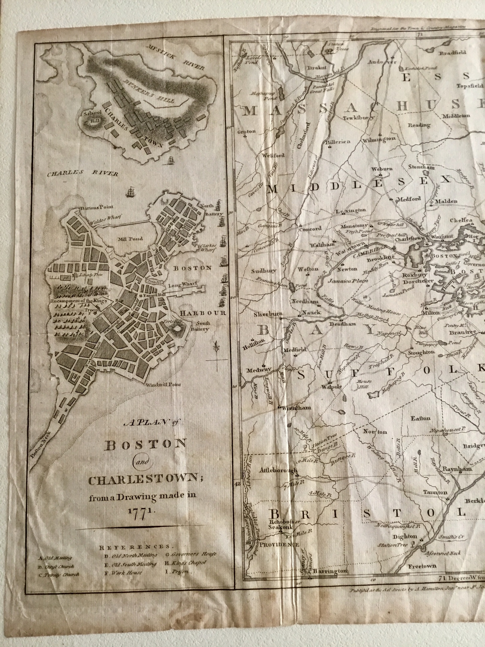
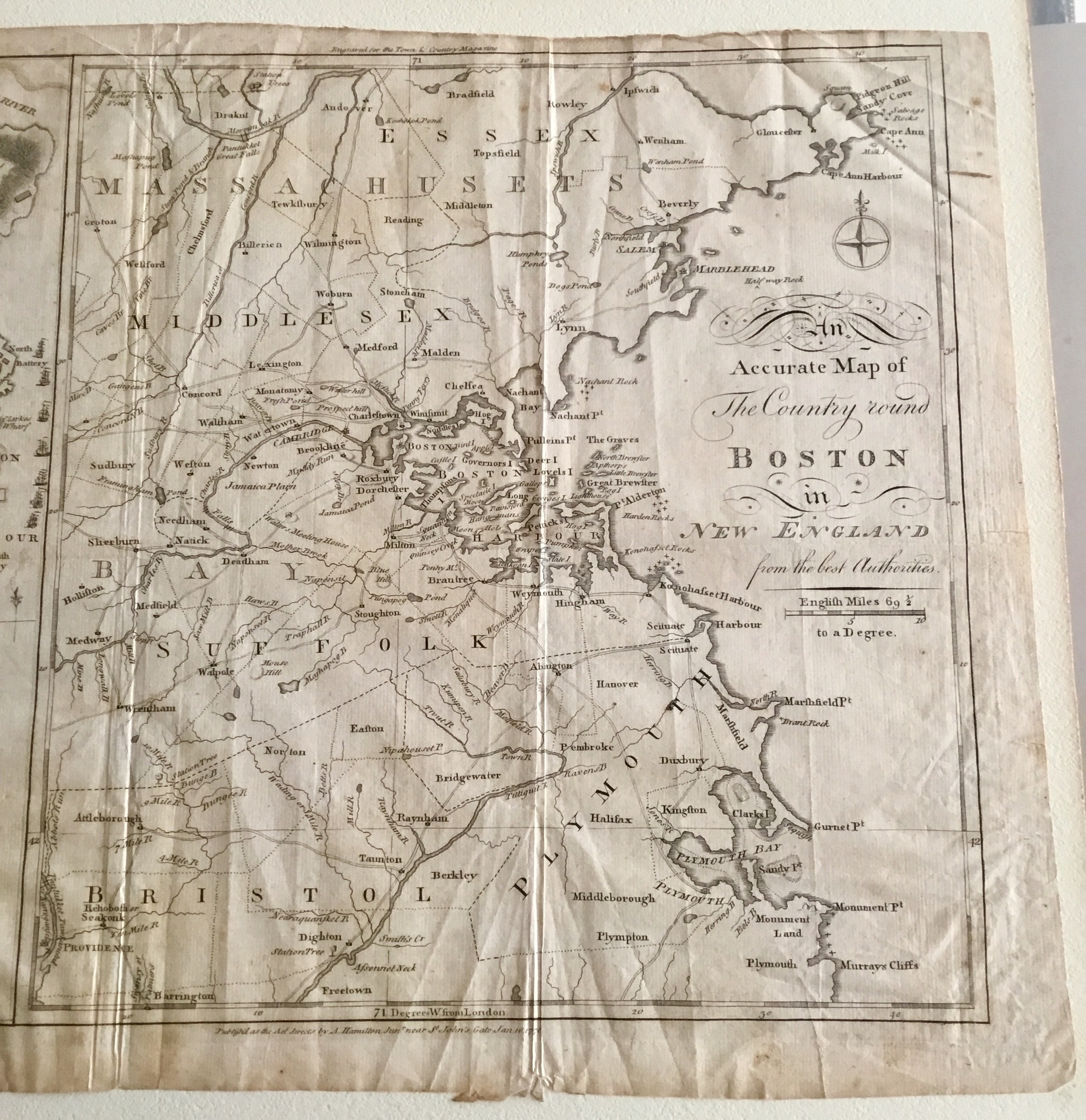
    A. Hamilton, Jr. (publisher), A Plan of Boston and Charlestown; from a Drawing Made in 1771 / An Accurate Map of the Country round Boston in New England from the Best Authorities , London; January 16, 1776.
    Bought at an Estate sale.

    logo
    Maps
    See all
    HAWAIIAN ISLANDS UNITED STATES 1788 RIGOBERT BONNE UNUSUAL ANTIQUE MAP
    HAWAIIAN ISLANDS UNITED STATES 1788...
    $110
    Antique 1845 Thayer & Ensign Travellers Guide United States Pull-Down Wall Map
    Antique 1845 Thayer & Ensign Travel...
    $235
    AUSTRALIA 1812 MALTE-BRUN UNUSUAL ANTIQUE ORIGINAL COPPER ENGRAVED MAP
    AUSTRALIA 1812 MALTE-BRUN UNUSUAL A...
    $42
    POLAND & LITHIANIA 1720 CHATELAIN UNUSUAL ANTIQUE ORIGINAL COPPER ENGRAVED MAP
    POLAND & LITHIANIA 1720 CHATELAIN U...
    $24
    logo
    HAWAIIAN ISLANDS UNITED STATES 1788 RIGOBERT BONNE UNUSUAL ANTIQUE MAP
    HAWAIIAN ISLANDS UNITED STATES 1788...
    $110
    See all

    Comments

    1. Alan2310 Alan2310, 8 years ago
      Fabulous find, always very like old map, I treasure.. well done.
    2. Foundaroundtown Foundaroundtown, 8 years ago
      Thank you Alan2310

    Want to post a comment?

    Create an account or login in order to post a comment.