


Posted 6 months ago
 Patriotica
(30 items)
If you were attending some sort of community school in 1865, The Civil War (or the War Between the States for those who lost) would have officially ended by the surrender of the Confederate States forces at Appomattox Courthouse, Virginia on April 9th, 1865. But you wouldn't have learned about it quite yet.
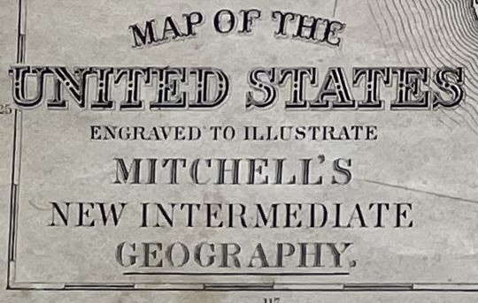
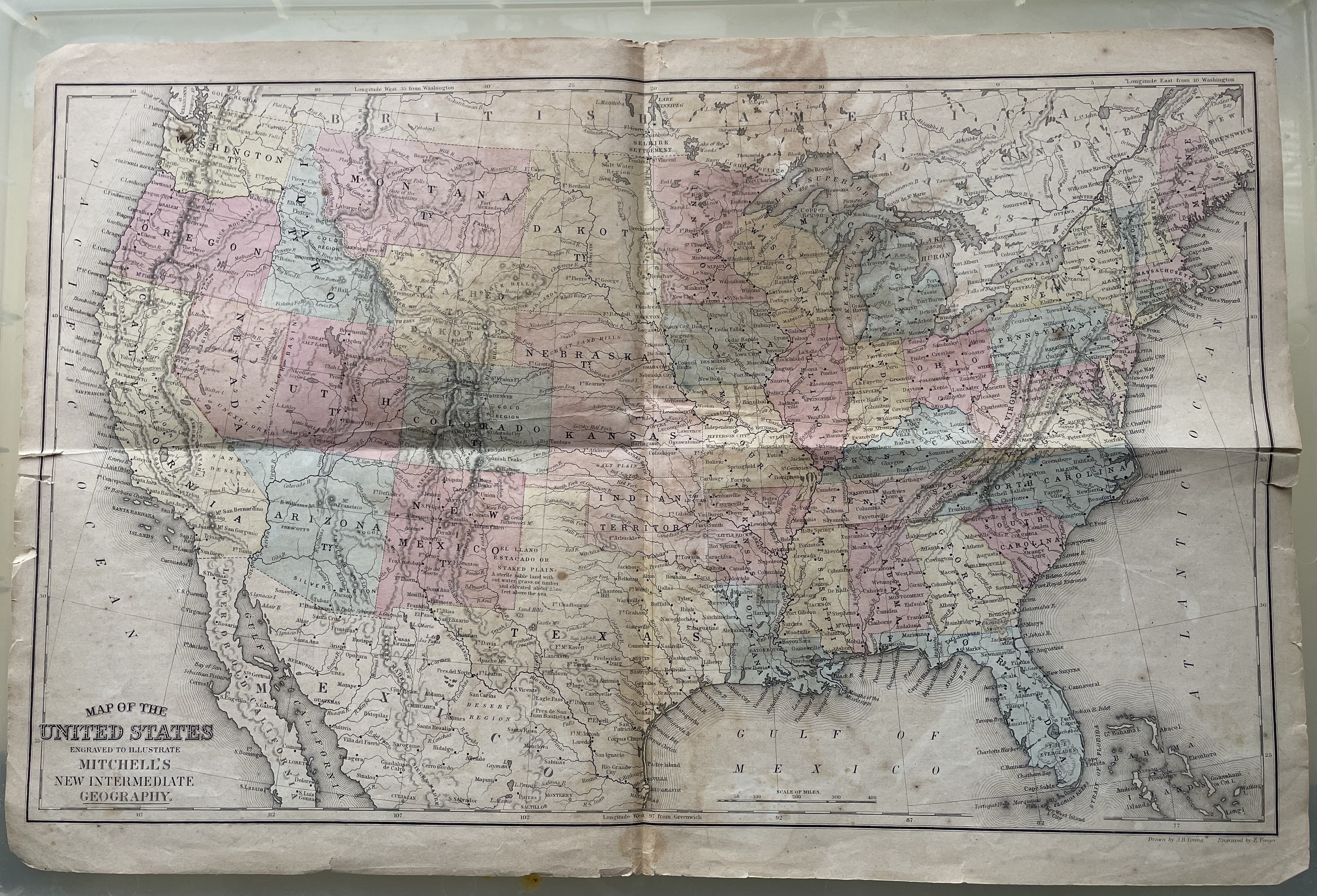
At the time community schooling was more locally controlled with a 'teacher-centered' approach giving them more personal leeway as to what was taught and what materials to use mostly based on what the community wished to be taught. Teachers would have access to specialized books and materials such as 'Mitchell's System of Modern Geography', where this map was tipped in, that would contain everything a geography lesson could be taught, including detailed, colored coded, detailed national fold out maps such as this one printed in 1865 perhaps knowing it left out the Civil War altogether.
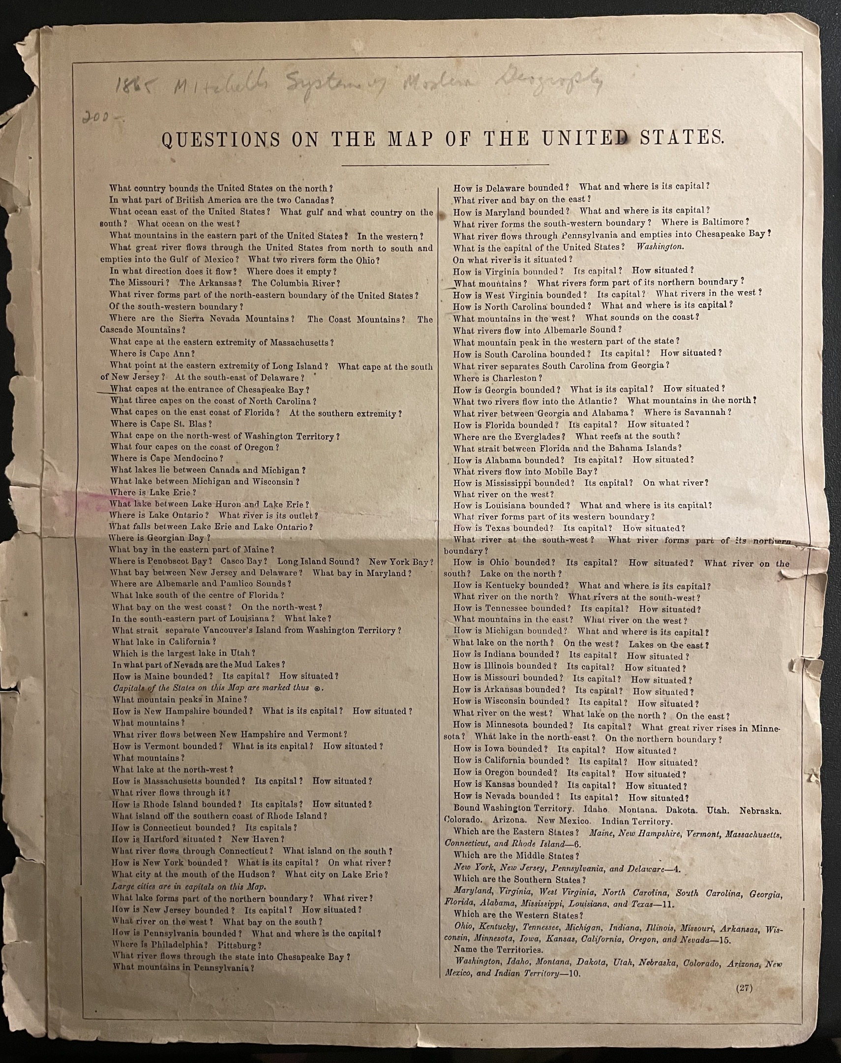
On the reverse of the map, the basic geography and natural resources of the United States are highlighted in seven numbered paragraphs. For example, paragraph number one says in part, "The United States of North America comprises that extensive portion of country lying between British America at the north and the Gulf of Mexico at the south; and included between the Atlantic and Pacific Oceans." British America, of course, refers to present day Canada (it was officially the British Province of Canada even then and not British America) and the United States was never officially named 'The United States of North America.'
Other paragraphs emphasizes its natural features (varied and remarkable), the climate (varying with the latitude...that is conducive to health, energy, and longevity), its 'productions' (extensive and various) and minerals (valuable). Questions on the Map of the United States are also helpfully included to guide the teacher on how much the students retained from reading the text such as: Where is Lake Erie?, What island is on the southern coast of Rhode Island?, Name the territories? (there were ten, can you name them?) and Which are the Southern states?, for example. The questions do ask for Western, Eastern, Middle and Northern states, too, though it names West Virginia and Maryland as Southern states (neither were in the Confederacy) and, curiously, places Arkansas, Tennessee (which both were), Ohio, Indiana, Michigan and Minnesota, among other Midwest states, as Western states along with California.
Granted, schools of this period were smaller and mostly included children of all ages in one small school house in agricultural and rural areas which comprised about 60% of the country at the time. Children between ages 8 and 14 had to go to school for 12-16 weeks a year focusing mostly on the three R's (reading, 'riting and 'rithmetic) and once graduated the 8th grade didn't usually continue, but instead began working the farm full time to sustain the family.
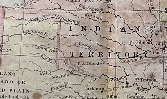
Still, this is an interesting piece of American history that tells its story by the land it occupies, not necessarily the history of how it got that way or how correct it was. The only mention of its Native Americans (even among the questions) is only one specially named area on the map identified as 'Indian Territory' that would later become the State of Oklahoma itself a Choctaw word from okla (people) and humma (red) translating to "red people" or "the land of the red people", so I guess that's something.
Its appreciated that it is a geography lesson and not one on the history of the United States. Sure, it wasn't meant for anything more than general knowledge for a very short educational period, but you would think that at least some basic history would be told and that it would be more accurate.
And curious, too, is that many communities today insist they want to return to the 'teacher-centered' or 'parent controlled' way for local schools without the 'meddling' of school boards or government entities. If so, then we'll get more generic school material that looks more like this.
Oh, wait...


Wonderful post and excellent write-up!!